New Zealand truly is a hiker’s paradise. There are countless spectacular day (and half-day) hikes to do in New Zealand, and especially in the South Island. You really can’t come to the South Island of New Zealand and not go hiking! It’s one of the absolute best things to do here.
Now, I’m certainly not going to claim to have done all the day hikes available on the South Island. Or even half of them for that matter!
You could spend a lifetime trying to complete all the incredible hiking tracks the Department of Conservation (DOC) provide and maintain in New Zealand. But, even with the (relatively limited) day hikes we’ve completed during our unforgettable time in the South Island, it’s actually quite difficult to pick the best ones!
Still, with Omer’s input, I’ve done my best to list our favourite South Island day hikes to get you on your way to exploring some of the amazing natural beauty Aotearoa has to offer!

PS – This post may contain affiliate links: That means that if you purchase through my link, I will receive a small commission at no additional cost to you. Of course, I only recommend products/services that I have used and believe are great! Please read my disclosure for more info.
Important Things To Note
Before we jump in, there are a few really important things I want to make sure I cover;
- New Zealand’s South Island is mountainous and most of these amazing day hikes are going to take advantage of those mountains, which means plenty of climbing!
- As a result, most of these hikes will require at least a moderate level of fitness. Please only attempt hikes you feel comfortable doing
- Stick to the marked tracks at all times! And give yourself enough daylight hours to hike in and out
- Bring more water than you think you’ll need. There normally won’t be any opportunities to re-fill so bring at least a couple of litres per person
- Bring plenty of food and snacks as well, to keep your energy levels up
- Wear/bring layers. The weather can change surprisingly quickly, especially at higher altitudes and while you might start your hike in warm and sunny weather, it could be very cold at the top. Make sure you have layers to put on, including hats and gloves!
- Wear good hiking shoes/boots! Many trails are rocky, muddy and/or slippery so you’ll need shoes with good grips
- Sunscreen is a must at all times in New Zealand. The sun here is intense and you’ll burn in no time. Even if the day starts out cloudy, go prepared (see above)
- Always pack your rubbish out with you!
- For you drone flyers out there – Flying drones is generally banned in New Zealand’s national parks, and many other places too. So pack your regular camera instead

So, let’s get to it! Here are our top picks for the absolute Best Day Hikes in New Zealand’s South Island (listed north to south)
Puponga Hill Top Walk – Cape Farewell
| Time Needed: 3 hours
| Distance: 8 km return
| Difficulty: Easy
Cape Farewell is the northernmost part of New Zealand’s South Island, and the area is actually shaped a bit like a Kiwi bird! (Honestly! Look at the map sideways, and you’ll see that Farewell Spit is the beak).
There are a number of different walks of varying lengths that you can choose from in the area, but I highly recommend the Pillar Point Lighthouse Track via Old Man Range.
This half day hike will take you through rolling farmlands, giving you wonderful panoramic views over Farewell Spit. It’s a fairly exposed track so take extra care as it can get windy and some of the track is along the cliff edge. Try to pick a sunny day if you can!
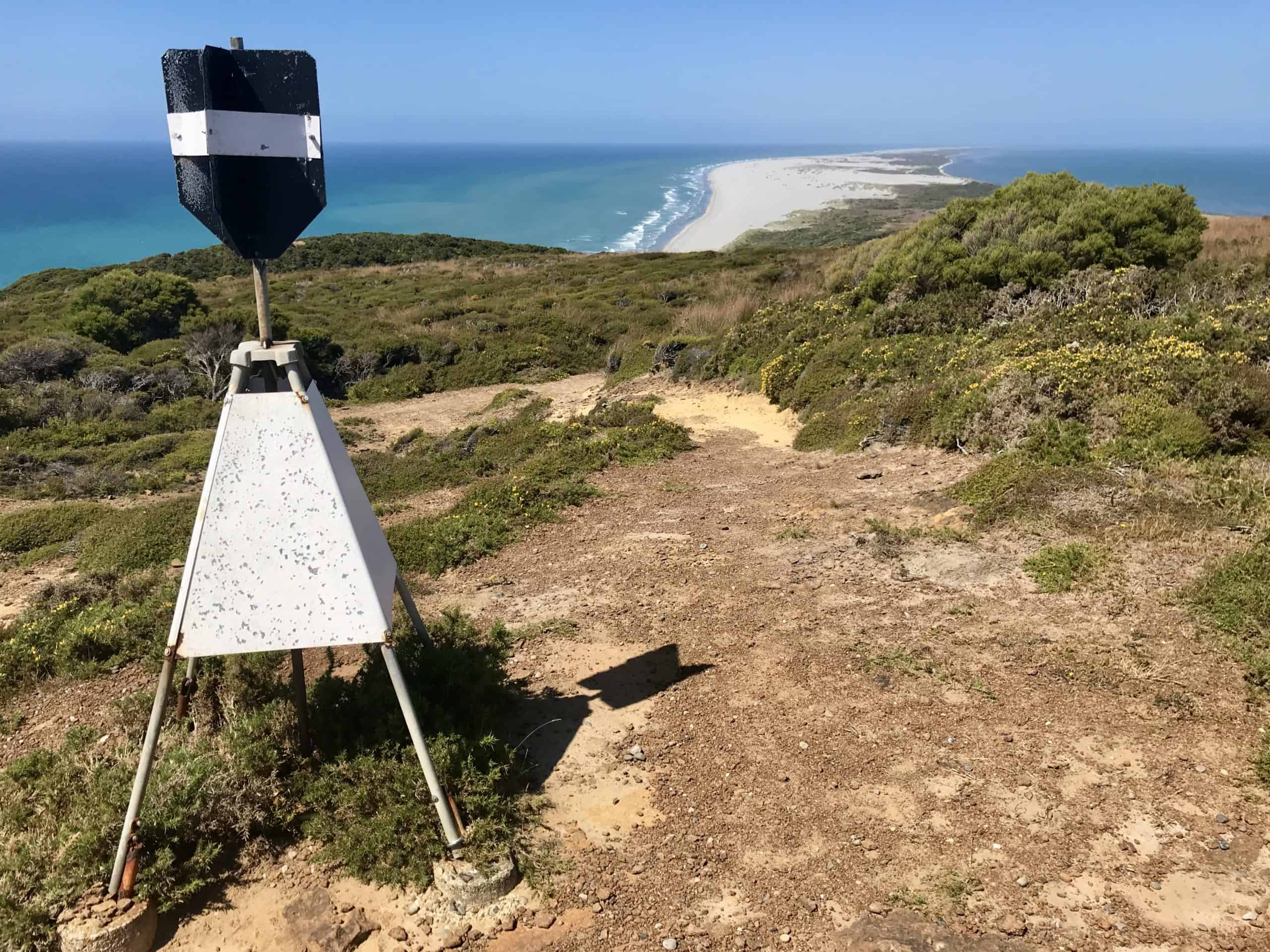
Start at the Triangle Flat car park and hike along the Puponga Hill Top Track to the lighthouse. On your return, you can walk down to the spit itself, and walk back along the Spit Track Circuit to mix it up a bit.
Granted, the lighthouse itself is nothing to write home about (unlike Cape Reinga or Nugget Point Lighthouses, which are rather picturesque!) But, we enjoyed the walk immensely!
If you’re feeling extra energetic today, you could extend this day hike all the way to Cape Farewell itself (the actual northernmost point of the South Island) and on to Wharariki Beach beyond. This adds a further 3.6km to your hike each way though, so make sure you have enough time in the day to complete it.
Alternatively, you can drive most of the way to each of these as well. Cape Farewell lookout is a short stroll from the carpark, and Wharariki Beach is just a bit further down a gravel road, and a 20 minute (1km) walk each way from Wharariki Beach car park. Wharariki Beach is definitely worth a visit in its own right as part of your time in the Tasman region!

Abel Tasman Coastal Track Day Hikes (Totaranui – Seperation Point)
| Time Needed: 4.5 hours
| Total Distance: 14.4km return
| Difficulty: Easy
Yes, the full Abel Tasman Coastal Track is a multi-day hike. But! If you’re not really into carrying everything you need for overnight hikes, there’s no reason why you can’t create your own day hikes in Abel Tasman like we did. We stayed at the Totaranui DOC campsite for three nights, and explored both north and south from there.
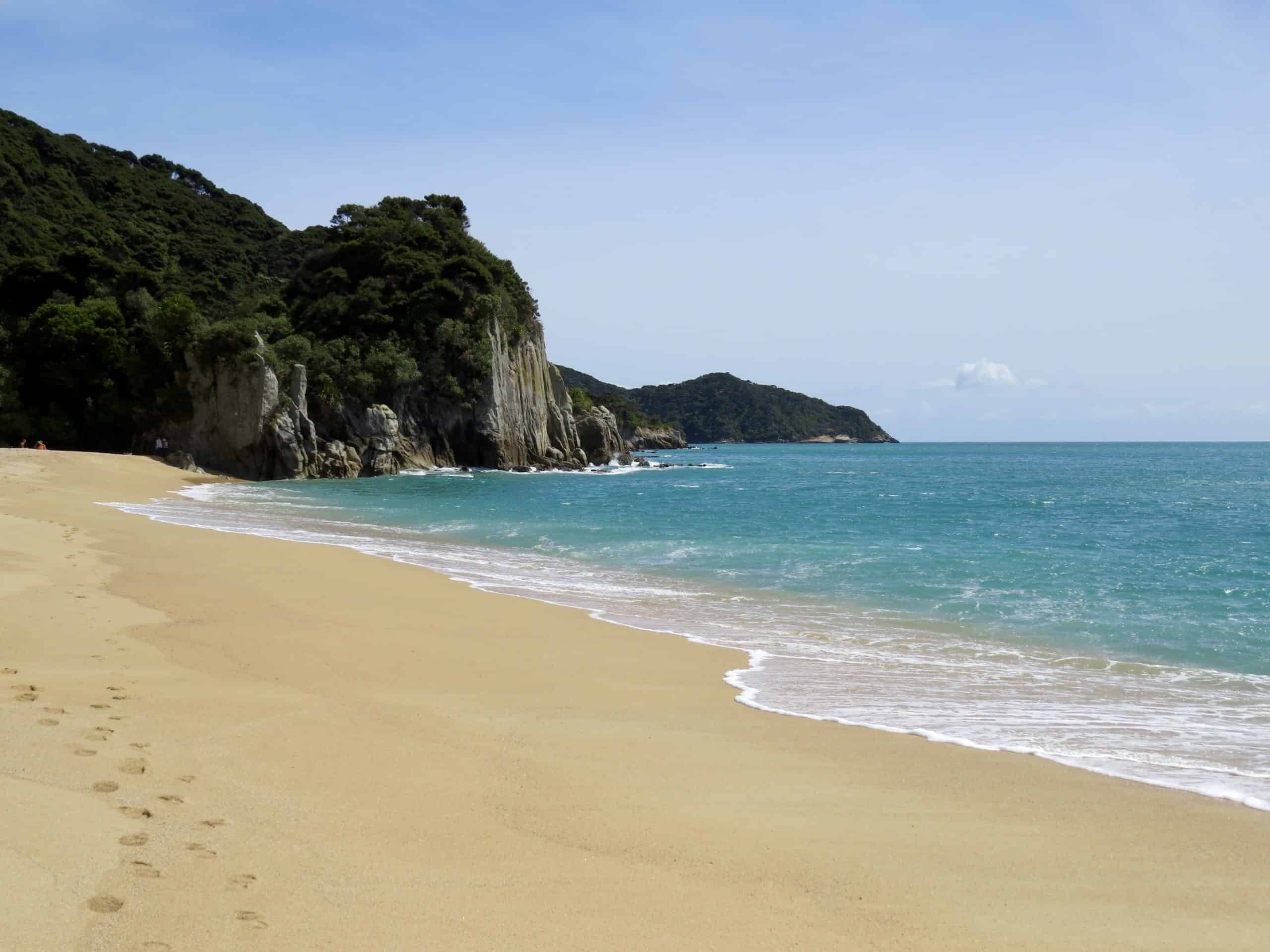
If you decide to do just one day hike in the Abel Tasman National Park, my personal preference goes to hiking north from Totaranui to Seperation Point. We very much enjoyed this day hike through multiple little bays of golden sand to the spectacular (and windswept!) Seperation Point, where we tucked into our packed lunch while watching some seals playing in the surf.
On this incredible (and best of all – easy!) day hike, you’ll pass through the stunning Anapai Bay (my personal favourite!), followed by Mutton Cove. Both are great places to cool off on your way back to Totaranui if you’re so inclined.
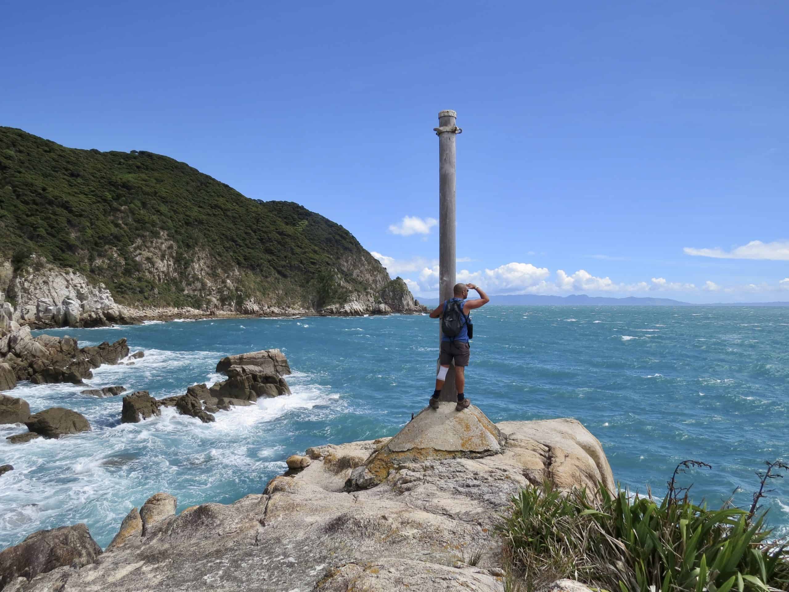
Seperation Point itself was incredibly windy as it’s pretty exposed out to the Tasman Sea. If you hear some funny sounds, it may well be a recording of gannets, as they’re attempting to establish a gannet colony here! They’ve even got an arrangement of fake gannets to attract the real birds!
Note: Access to Totaranui is on a 10km stretch of unsealed road. While it’s mostly in pretty good condition, it does get a little narrow in parts, so take your time and share the road!

Roberts Point – Franz Josef Day Hike
| Time Needed: 5-6 hours
| Total Distance: 12.3km return
| Summit Height: 605m
| Elevation Gain: 548m
| Difficulty: Advanced
For me, Roberts Point was quite possibly the most enjoyable day hike that we did during our time in the South Island!
It’s listed as advanced because it’s a somewhat technical hike. You’ll be scrambling across rocks and streams, pulling yourself up on tree roots, and crossing no less than 4 rather epic swing bridges! Oh, and scaling along some platformed steps that have been bolted into the side of the cliff!
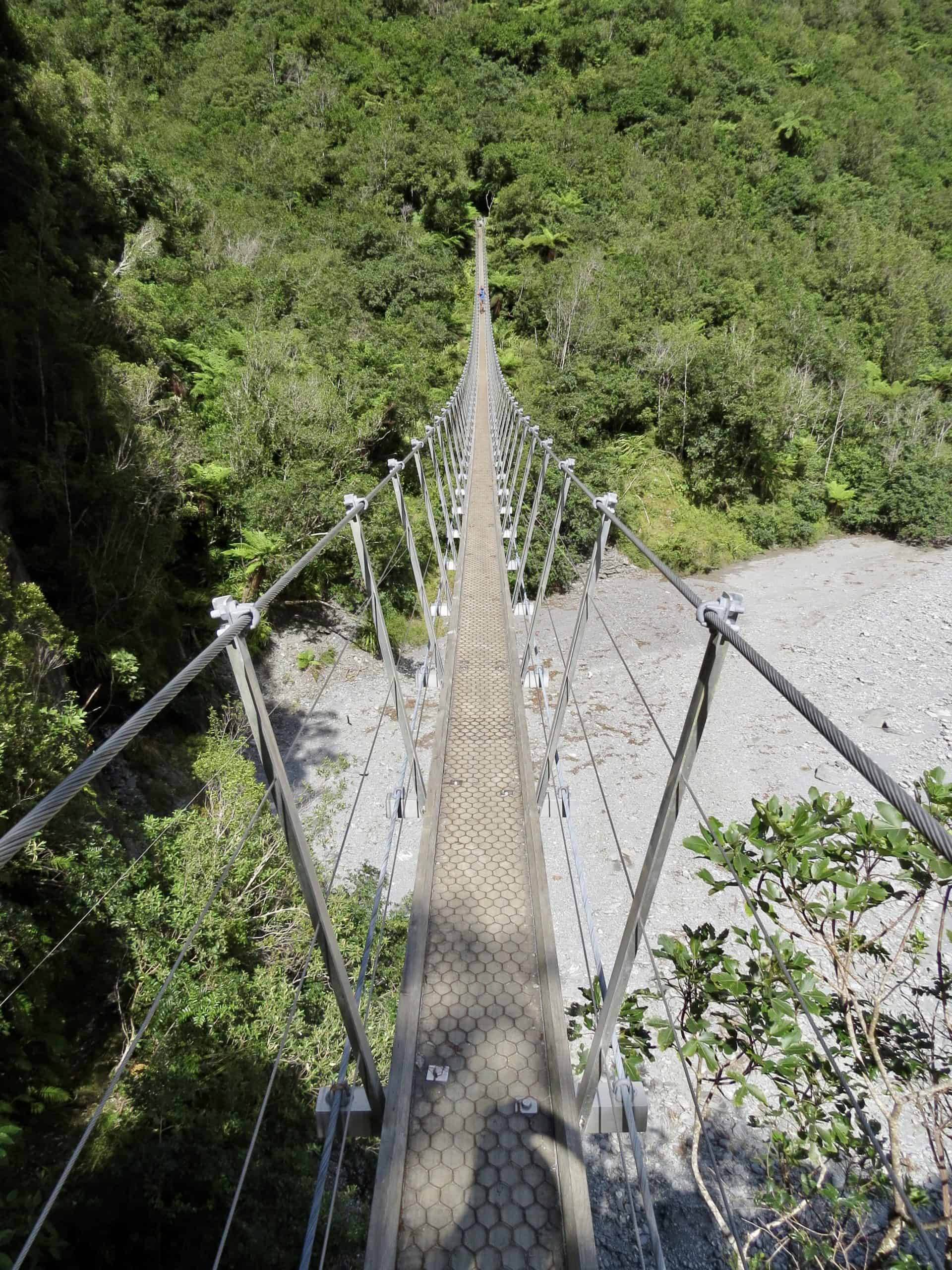
Although the track is fairly well-maintained at the start, this changes the further you progress along the hike. You won’t have a clear path to follow most of the way, only the orange triangles that DOC puts up to show you the way.
But, all of that is what made the Roberts Point track such a fun and adventurous day hike! Not to mention the incredible view of Franz Josef glacier once you reach Roberts Point viewing platform. This is arguably about as close as you’re going to get to Franz Josef glacier now, without doing a heli-hike or helicopter landing (Side note: We actually did a heli-hike with Fox Glacier Guiding too, which was Amazing!)
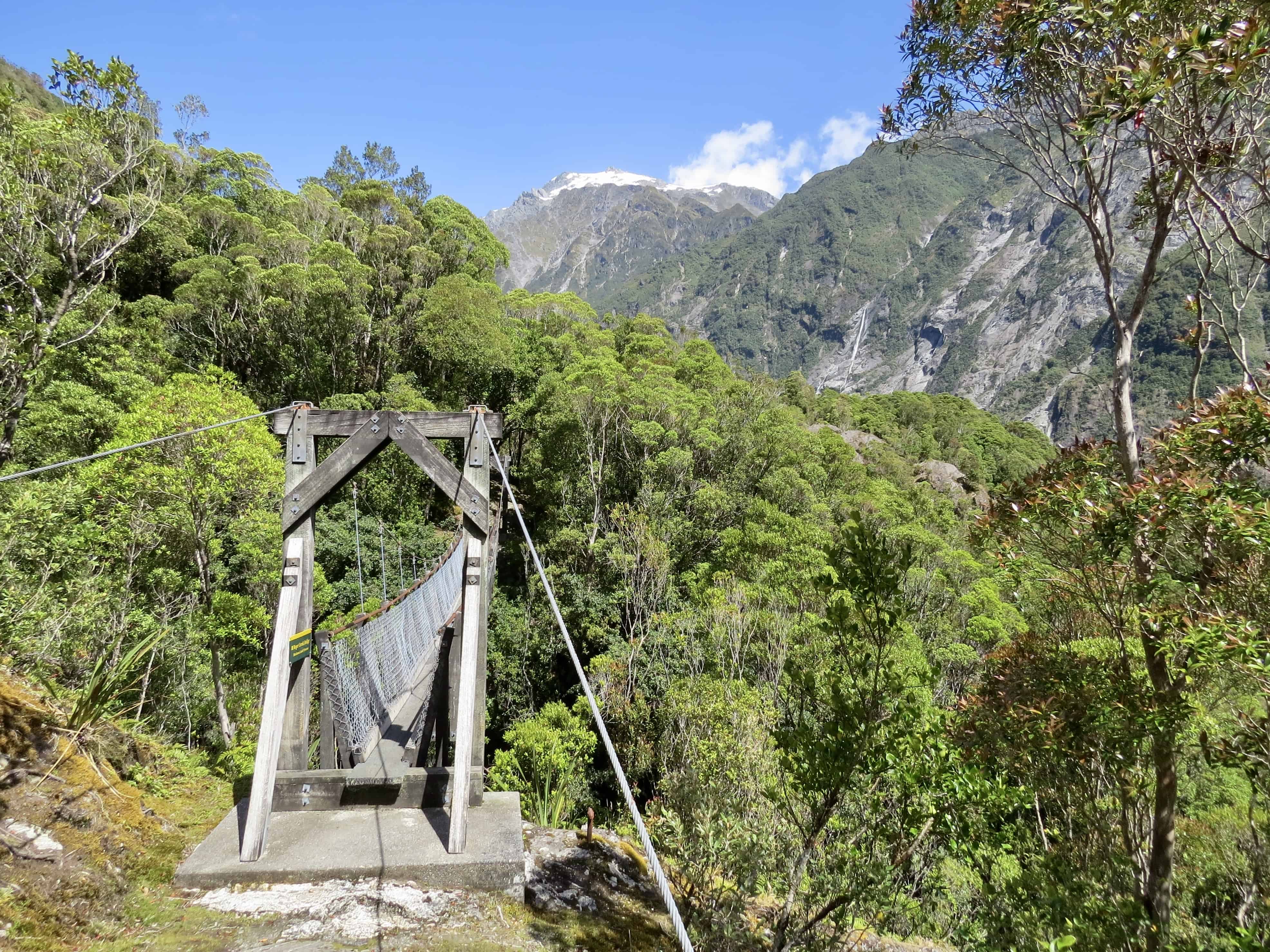
As well as the glacier, you’ll see multiple tall waterfalls cascading down the sheer rock face across the glacial valley. If you’re extra lucky, you may even spot a Kea or two at the viewpoint picnic area.
Important: DOC lists this as an Advanced track and they suggest that it should only be attempted by experienced hikers due to the technical difficulty in parts. I’d definitely suggest avoiding the track in wet weather as it might be dangerous and slippery.
To get to the Roberts Point track, park at the Frans Josef Glacier car park (right at the end of the road). Start along the Douglas Walk which branches off to Roberts Point track after about 1.5km.
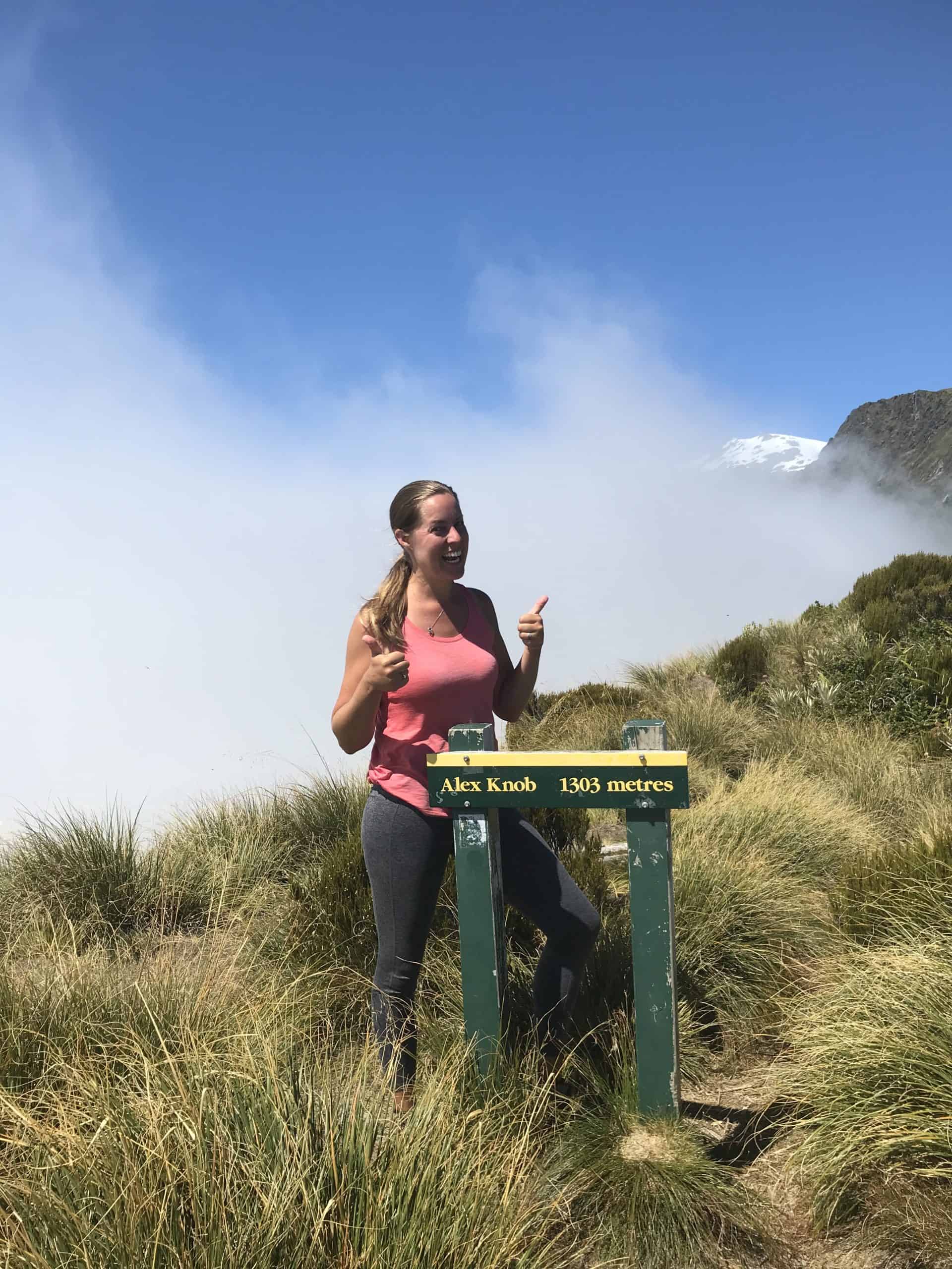
Alex Knob – Franz Josef Day Hike
| Time Needed: 7-8 hours
| Total Distance: 17.2km return
| Summit Height: 1303m
| Elevation Gain: 1081m
| Difficulty: Advanced
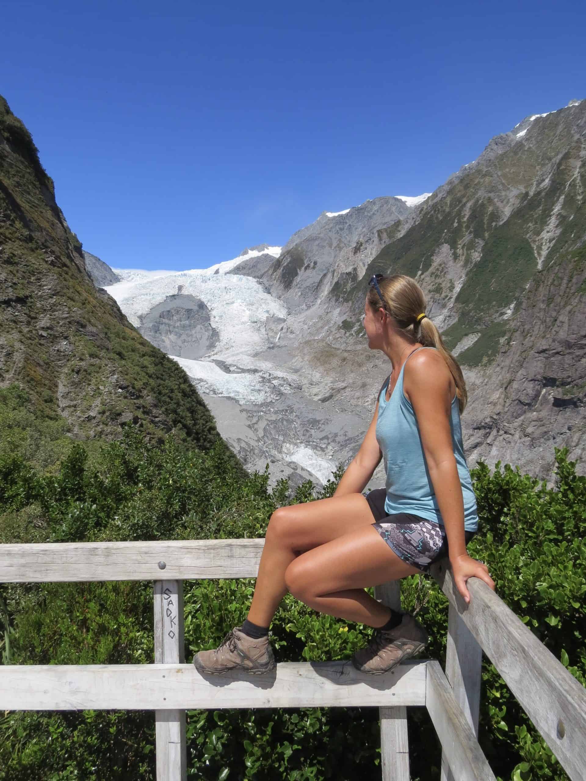
The Alex Knob track is one of the more challenging but extremely rewarding day hikes in the South Island. It’s demanding primarily due to the length and elevation gain, as the track is quite well maintained overall, and clearly marked.
Initially, the trail winds its way through lush native bush before turning into tussock as you reach the higher altitudes.
I loved seeing the vegetation change as we climbed higher!

The great thing about the Alex Knob day hike in Franz Josef is that you’ll have a couple of lovely viewpoints along the way to keep you motivated as well.
And then, once you reach the Alex Knob summit, you’ll be rewarded with some incredibly stunning views of Franz Josef glacier and the surrounding mountains. While you won’t get as close as you do at the Roberts Point viewpoint, the angle and elevation here make for some breathtaking views!

I really had to push myself on this hike, as we were trying to beat the weather to the top as well! We were walking in clouds for about half the hike and other hikers coming down told us the weather was rapidly closing in at the top.
Luckily, we made it to the summit in time for a truly spectacular view above the clouds (before they completely obliterated the view!!)
Insider Tip: We stayed at the Rainforest Retreat in Franz Josef, which we loved! It’s a really great spot to base yourself for your time in Glacier country. Luxury, budget and camping options available!
Hooker Valley Track – Mt Cook Day Hike
| Time Needed: 3 hours
| Total Distance: 10.5km return
| Elevation Gain: 80m
| Difficulty: Easy
The Hooker Valley Track in the Aoraki / Mount Cook National Park is another incredibly beautiful and (unsurprisingly) popular half-day hike to do in the South Island of New Zealand.
This walk is fantastic because it’s so accessible and quite manageable for people of all fitness levels. Most of the well-built track is flat, with a mix of gravel path and boardwalks, as well as three swing bridges leading you up the Hooker Valley and along the Hooker River.
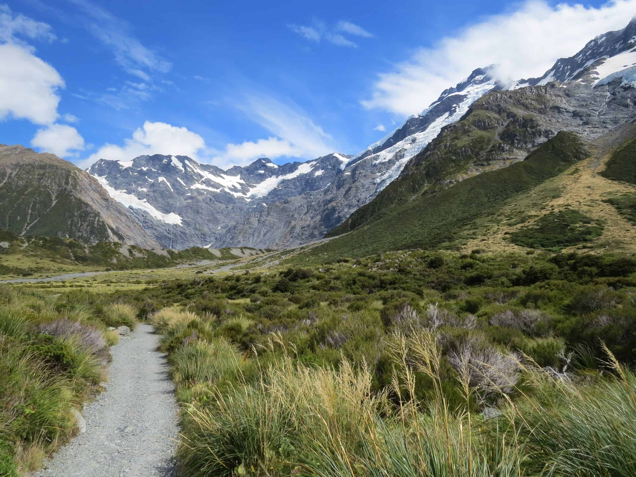
You’ll want to take your time to enjoy the superb views of the surrounding mountain peaks (including, of course, New Zealand’s highest peak, Mount Cook) and the Mueller Lake, before getting to the picturesque Hooker glacial lake which might even treat you to some icebergs!
As you go, keep an ear out for the rumbling of rock and/or snow avalanches from nearby Mount Sefton! We spotted a few of them, although they can be easy to miss as the sound is delayed.

Insider Tip: Aoraki/Mount Cook National Park is one of the best places in New Zealand to view the night sky. With no cities or towns anywhere nearby, this is the place to be for stargazing on a clear night!
Sealy Tarns (Mueller Hut Track) – Mt Cook Day Hike
| Time Needed: 3.5 hours
| Total Distance: 5.6km return
| Summit Height: 600m
| Elevation Gain: 552m
| Difficulty: Intermediate (steps = tiring!)
Note: This is from the White Horse Hill Campground – it’s longer if you start from Mount Cook Village
Sealy Tarns is not difficult if you’re good at climbing stairs! Nicknamed “Stairway to Heaven,” there are 2200 steps to take you to the tarns, giving you quite the workout!
It is hard work, but it also means you’re able to gain a lot of altitude quite quickly. As a result, you’ll have some truly spectacular views unfold below you as you climb. We saw our van down at the White Horse Hill Campground become smaller and smaller and smaller the higher we got!

There’s a (somewhat obscured) sign to point you right to Sealy Tarns and left to Mueller Hut at the very top of the stairs.
The tarns (glacial mountain lakes) are really just small ponds that aren’t very spectacular, and certainly not the main reason for doing this day hike (Surprise! The views are!). Just a little bit further on there’s a picnic bench that’s the perfect spot to catch your breath, and enjoy your packed lunch while soaking up the incredible views!

From there, you can choose to continue on to the Mueller Hut track. This part is way more challenging, as it is mostly scrambling over boulders of various sizes while still ascending at quite a speed. The total height gain to Mueller Hut is 1000m and takes 3-4 hours one way.
We did actually go all the way to Mueller Hut. But, if I’m honest, I’m not sure its worth it unless you’re planning to stay overnight at the hut. The sunrise at the top may well be worth doing that for. (If this is your plan, make sure you book your bed in advance!) But, the views from Mueller Hut compared to Sealy Tarns are minimally different and so, if you’re looking for a manageable day hike, I would opt for Sealy Tarns and back.

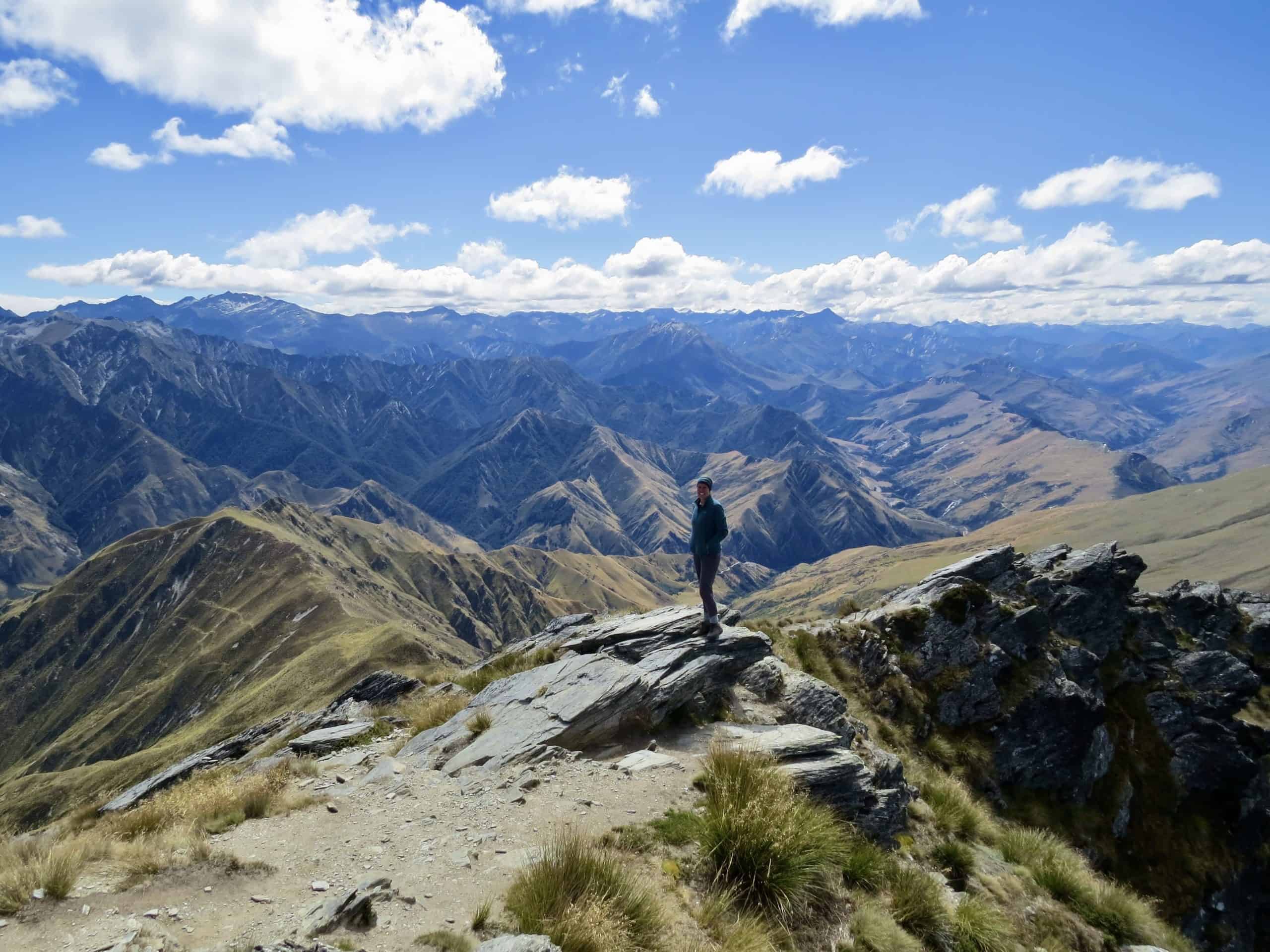
Roys Peak – Wanaka Day Hike
| Time Needed: 5-6 hours
| Total Distance: 16km return
| Summit Height: 1578m
| Elevation Gain: 1305m
| Difficulty: Intermediate (steep & tiring!)
Note: DOC lists this walk as easy, but I disagree! While it’s easy in the sense that you follow a 4WD track all the way up, you’ll need a good level of fitness and perseverance to complete this hike!
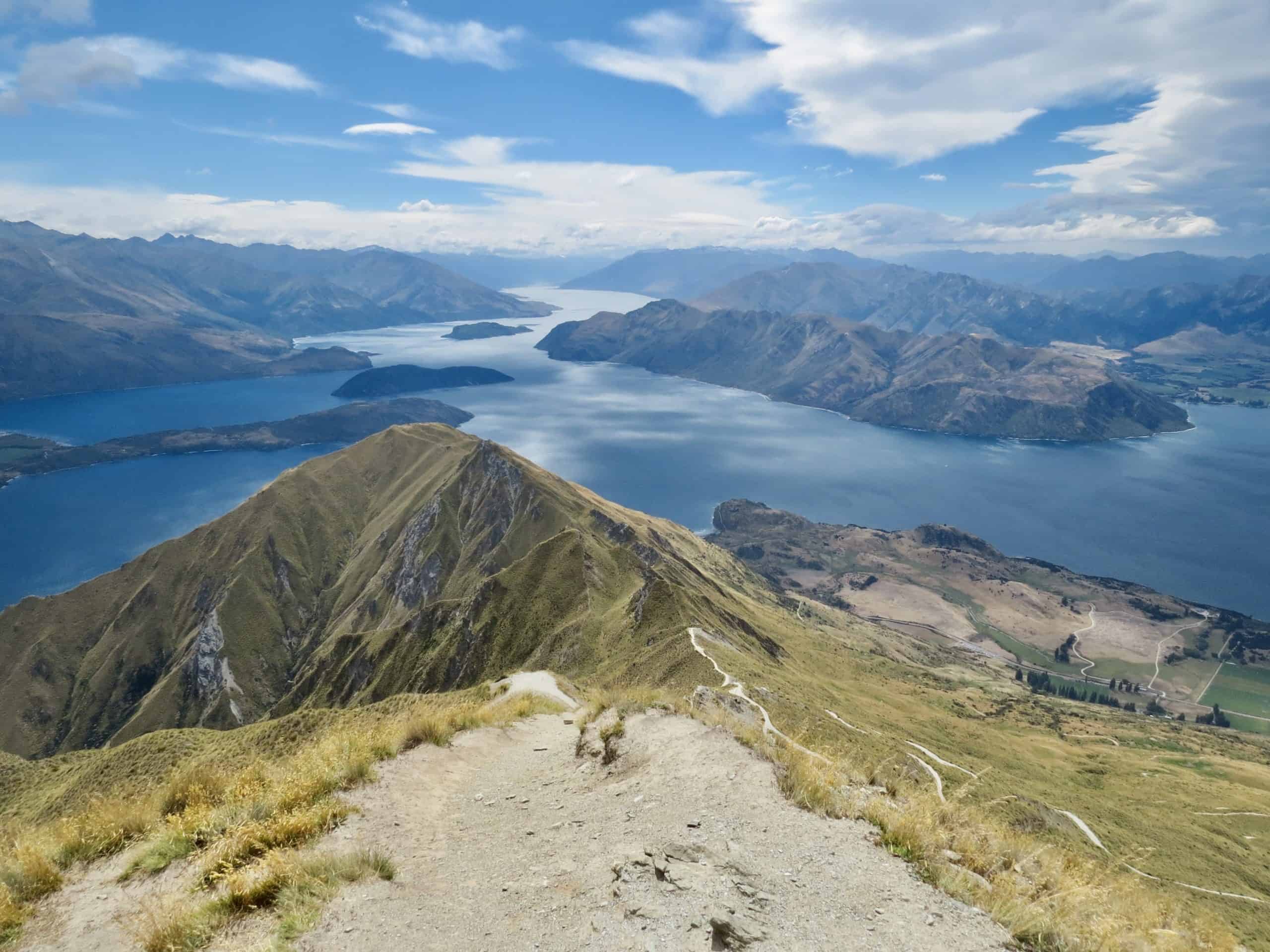
Although Roys Peak is one of the most popular and well-known day hikes in the South Island (and even in all of New Zealand!), I had a bit of an internal debate about whether or not to put the Roys Peak day hike in Wanaka on this list.
Honestly, the hike itself is quite boring… It’s a relentless, monotonous and exposed 8km upward hike. It’s not technically difficult in any way, but it’s really tiring. Be prepared for some sore leg muscles the next day!

But, once you reach the top, you’ll realise why you persevered, and why so many people do this hike in Wanaka. It’s the panoramic views across Lake Wanaka, Wanaka town and the surrounding mountains that make it all worthwhile.
It took us about 2.5 hours to reach the peak, and another 2 hours down. What we hadn’t realised is that Roys Peak itself is actually another 1.5km / 30 minutes up from *that* photo spot made super famous by Instagrammers!
Do make sure you head all the way up to the summit, as the views at the peak are honestly much better than at the viewpoint!
As I mentioned, the Roys Peak track is completely exposed to the elements for the entirety of the hike. Also, the temperature at the peak can be really cold, even in summer. Make sure you wear layers, and sunscreen!
Important Note: The track is closed each year during lambing season between 1 October – 10 November.

Ben Lomond – Queenstown Day Hike
| Time Needed: 6-8 hours
| Total Distance: 11km return
| Summit Height: 1748m
| Elevation Gain: 1438m
| Difficulty: Advanced
If you’re looking to do something beyond the extreme adventure sports Queenstown has to offer, then the Ben Lomond day hike should definitely make it on to your itinerary! While it’s a steep track requiring a high level of fitness, you’ll be rewarded with spectacular 360 degree views over Queenstown and surroundings.
The Ben Lomond track begins with the so-called 2 km long Tiki Trail at the base of the Queenstown Gondola. This part is arguably the most tedious part of the hike. It will take you about an hour and makes up 400 of the 1400 or so meter elevation gain.
Insider Tip: If you think you’ll struggle, are short on time, or just want to cheat a bit, you can take the Gondola up to cut 400 meters and about an hour off your walk in each direction!

Please note that at the moment (autumn 2021), there is some work going on at the top of the Queenstown Gondola, making the start of the Ben Lomond hike there a bit difficult to find. The signage isn’t great and although we asked the staff, we were still a bit unsure… Essentially, you’ll want to head left and up towards the Skyline Loop Track, rather than right towards the Luge where you’d normally start.
From here, you’ll first hike to the Saddle, where there’s a bench to rest up for a bit before you tackle the more challenging part of the track up to the summit. Unlike what I recommended for Sealy Tarns (above), I absolutely, 100% recommend persevering and going all the way to the peak of Ben Lomond.
Although the second part of this day hike is steep and challenging, the views are exceptional and well worth the effort.

As the Ben Lomond hike starts in Queenstown itself, you’ll have to plan ahead a little bit for parking. The parking on Brecon Street is limited to 4 hours, which won’t be enough even if you’re a fitness bunny. However, there is plenty of free unlimited on-street parking in the area, just a little further away, such as on Isle Street and Man Street to the left of Brecon Street.
Lake Marian – Milford Sound Day Hike
| Time Needed: 3 hours
| Total Distance: 6km return
| Summit Height: 695m
| Elevation Gain: 430m
| Difficulty: Intermediate
Many people come to Fiordland primarily to see Milford Sound. And, while I very much encourage you to do that (it is stunning!), please make sure you also give yourself enough time to explore some of the other gems in the area. Certainly, the serenely beautiful Lake Marian is high up on that list!
Don’t be fooled by the well maintained path for the first 10 minutes or so though! It’s actually quite a strenuous walk once you get past Marian Falls.
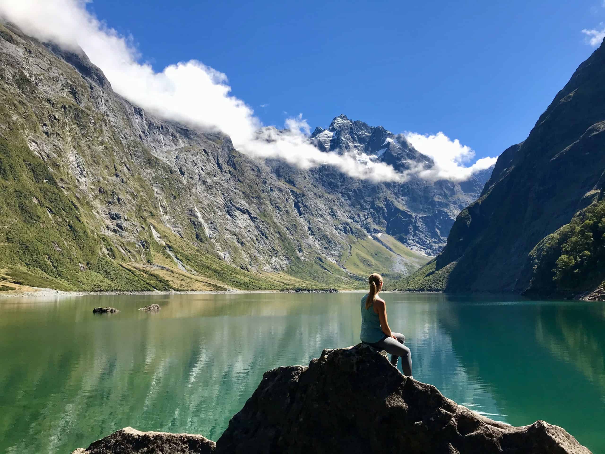
Although the DOC sign there states that there are “some rough sections underfoot”, this is quite misleading as you’ll find yourself climbing and clambering a bit to get to Lake Marian. The whole track is quite rough and not that well maintained, with a fairly constant uphill grade. There’s even one section where you basically use some tree roots to climb up a couple of metres to get out of a riverbed.
All in all, a bit of an adventure!
But, all your hard work will be more than worth the effort! And, as the trail isn’t too long (it took us about an hour and a half each way), it’s still a very manageable day hike to do during your time in the South Island.
Set high above the bush line, you won’t see the lake until the very end of this hike. But, once you do, the views of the jagged mountains surrounding the incredibly clear, turquoise-coloured alpine lake will take your breath away. On a calm day, the reflections here are pretty magnificent too!
Insider Tip: Bring your togs for a refreshing dip in the lake if the weather is nice.
To get to the start of the Lake Marian walk, you’ll need to turn off the main Milford Sound road and drive about a kilometre down the unsealed Hollyford Road.

Fun Fact: Believe it or not, gorgeous Lake Marian really reminded us a lot of our hike to Morskie Oko in Zakopane, Poland. Strange but true!
New Zealand truly offers something for everyone. Especially when it comes to hiking! From imposing mountains to picture perfect lakes, these nine incredible day hikes are some of my absolute favourite memories from our time in the South Island.
While many of these walks were quite challenging, there’s nothing quite like the sense of achievement you feel when you’re standing (hot and sweaty!) at the summit of some of these incredible hiking trails.
Have you done any hiking in New Zealand? Which trail was your favourite? Let me know in the comments below!
Related Posts You Might Like
Your Complete Guide To The Beautiful Morskie Oko Hike From Zakopane
How We Afford To Travel The World (& How You Can Too!)
7 Beautiful Hidden Gems On New Zealand’s North Island
Renting A Car In New Zealand – Your Self-Drive Guide
How To Talk Like A Kiwi – Understanding New Zealand Slang
Lovely photos.
A time to remember
Thank you 🙂 It’s definitely going to be something we’ll remember for a long time to come